
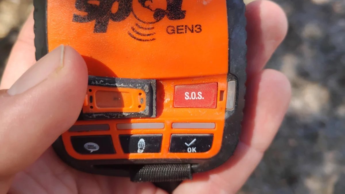
The act of depressing an emergency SOS button on a satellite communication device carries a profound psychological and operational weight. Far from being a mere button press, transmitting a distress signal from the remote backcountry initiates a massive, coordinated chain reaction involving commercial dispatchers, international satellite constellations, governmental search and rescue (SAR) departments, and frontline emergency responders. Each time an adventurer calls for help, they hand over the ultimate responsibility for their personal safety, compelling rescue operators to assume physical risks in order to mitigate the consequences of backcountry emergencies.
As outdoor recreation surges to unprecedented levels globally, understanding the mechanisms, providers, and systemic implications of satellite distress technology has never been more critical. The infrastructure supporting these rescues operates across diverse networks, proprietary communication channels, and varying protocols, fundamentally transforming modern wilderness exploration.
The Escalating Demand for Wilderness Rescues
The proliferation of affordable, user-friendly satellite communication devices has democratized backcountry safety while simultaneously shifting operational volumes for emergency services. Industry data indicates a dramatic upward trajectory in distress activations over the past two decades.
Texas-based satellite communications giant Garmin reports that its dedicated emergency response center has handled over 250,000 SOS alerts since the system’s inception in 2007, spanning virtually every country on Earth. Out of that total, more than 20,000 incidents required active coordination, averaging upwards of 1,000 operations annually. However, recent figures highlight an exponential acceleration. By 2025, Garmin logged more than 3,000 yearly emergency incidents, with trail and mountain-specific calls registering notable surges. To manage this relentless volume, the company maintains a continuous, 24/7 staffing model at its international response coordination center.
This growth pattern is mirrored on a global scale. Cospas-Sarsat, the internationally managed, humanitarian-focused satellite system utilized by emergency beacon manufacturers such as Ocean Signal, services a network representing 45 of the world’s largest economies. During the 1990s, the system recorded a few hundred SAR events annually. By 2024, that annual figure had climbed to well over 1,000 verified distress events.
Concurrently, the physical hardware deployed in the field has multiplied. Cospas-Sarsat estimated that more than 3.35 million devices capable of communicating with its 406 MHz network were actively deployed in the field by the end of 2024—a massive leap from fewer than 2 million units in 2017. Furthermore, market competition is fierce; in 2024 alone, the parent company of Garmin competitor SPOT reported a 35% year-over-year increase in device sales, underscoring the ubiquity of personal locater technology among modern hikers, climbers, and backcountry skiers.
Anatomy of a Rescue: How Different Systems Operate
While the basic premise of a satellite distress beacon remains simple—transmit a signal, alert authorities, and dispatch rescuers—the underlying infrastructure, communication pathways, and level of user interaction vary dramatically depending on the manufacturer and network.
The industry currently relies on three primary models: interactive commercial messaging networks, third-party managed commercial networks, and direct-to-government global satellite networks.
Garmin: The Two-Way Communication Standard
Operating on the robust Iridium satellite network, Garmin has established the de facto commercial standard for backcountry satellite communication.
When a user triggers an SOS on a compatible device, the unit transmits precise GPS coordinates via the Iridium constellation to the Garmin Response coordination center. This 24/7 facility immediately acknowledges the alert and initiates a two-way dialogue with the user to ascertain the nature and severity of the medical or logistical emergency.
Simultaneously, coordinators begin contacting local rescue agencies having jurisdiction over the user’s coordinates. To ensure real-time tracking, the device automatically updates the user’s location every minute for the first ten minutes of an SOS event, transitioning to a ten-minute interval thereafter. Coordinators also reach out to pre-designated emergency contacts to gather critical background data. Depending on the device capabilities—such as the inReach Plus series—coordinators can facilitate direct voice or text communication between the stranded party and the incoming rescue teams, continuing this monitoring loop until the incident is fully resolved.
SPOT: The Alternative Commercial Model
Competing directly in the consumer space, SPOT utilizes the Globalstar satellite network. While its operational philosophy closely mirrors Garmin’s, its routing infrastructure relies on an independent third-party provider, FocusPoint International, to manage emergency responses on a 24/7 basis.
Upon activation, a SPOT device routes GPS coordinates through Globalstar satellites to FocusPoint’s international response center. Coordinators verify the location, contact local SAR authorities, and execute predefined protocols that may include contacting the user and their designated emergency contacts.
Communication capabilities vary widely across the SPOT product lineup. Older or basic hardware configurations are limited to one-way communication, transmitting only distress signals and location data. Conversely, the SPOT X enables full two-way messaging between the user and rescue coordinators. Location tracking intervals are highly frequent, with the SPOT X transmitting position updates every 2.5 minutes until an acknowledgment is received, and every 5 minutes thereafter.
Ocean Signal and Cospas-Sarsat: The Subscription-Free PLB Approach
Contrasting sharply with commercial subscription models, Personal Locator Beacons (PLBs) manufactured by brands like Ocean Signal bypass commercial call centers entirely. Instead, these devices transmit distress signals directly into the Cospas-Sarsat international search-and-rescue architecture, requiring no ongoing subscription fees.
Cospas-Sarsat’s history dates back to 1979, when it was founded through an international collaboration between France, Canada, the United States, and the Soviet Union during the Cold War. It has since expanded to incorporate over 30 member nations.
When an Ocean Signal rescueME PLB3 is activated, it broadcasts a unique device identity and Global Navigation Satellite System (GNSS) position on the dedicated 406 MHz frequency directly to Cospas-Sarsat satellites. The signal travels via ground stations to a Mission Control Center, which routes the data to the appropriate Rescue Coordination Center (RCC).
The RCC verifies the emergency using registration details provided by the owner—such as typical recreational habits, medical notes, and specific trip itineraries—before dispatching local SAR resources. Communication capabilities on traditional PLBs are intentionally minimal. They lack text or voice messaging features, though modern units incorporate Return Link Service (RLS) technology to confirm that the distress alert has been successfully received by the network.
Where Ocean Signal units distinctively excel is in the terminal phase of a rescue. In addition to the global 406 MHz satellite alert, the PLB3 continuously broadcasts a 121.5 MHz radio homing signal that ground rescue teams can track using direction-finding equipment. Furthermore, for maritime emergencies, the device broadcasts an Automatic Identification System (AIS) distress position directly to AIS-equipped vessels within VHF range, allowing nearby civilian or commercial watercraft to navigate immediately to the scene.
Chronology of a Backcountry SOS Activation
Understanding the timeline of an emergency response highlights the complex logistical gears turned by a single button press. While every incident is unique, a typical high-efficiency rescue operation follows a structured chronological sequence:
- Minute 0: The user activates the SOS mechanism on their satellite device. The unit acquires a satellite lock and transmits a localized distress packet containing unique identification numbers and precise geographical coordinates.
- Minutes 1 to 5: The signal traverses the atmosphere, hitting either a commercial satellite constellation (Iridium or Globalstar) or governmental SAR satellites (Cospas-Sarsat). The data is routed to a 24/7 operations center (Garmin Response, FocusPoint, or an RCC).
- Minutes 5 to 15: Dispatchers authenticate the emergency signal, check device registration databases, and initiate preliminary two-way text communication with the user (if supported by the hardware) to determine the exact nature of the medical or structural crisis.
- Minutes 15 to 30: Coordination centers cross-reference the GPS coordinates with regional geographic data, identify the appropriate local search and rescue authority, and transmit the verified package of information to local sheriffs, park rangers, or volunteer SAR teams.
- Minutes 30 to 120+: Local rescue teams mobilize personnel, equipment, and potentially aviation assets. For the duration of the operation, response centers maintain continuous positional tracking and relay real-time updates between the field teams and the subject until extraction is complete.
Broader Implications and Systemic Challenges
The widespread adoption of satellite emergency beacons has indisputably saved thousands of lives, dramatically shortening the window between injury and medical intervention in remote terrain. However, the surge in device deployment introduces notable economic, legal, and operational challenges for emergency services.
Many local search and rescue teams—frequently reliant on volunteer labor and funded by municipal budgets or outdoor recreation permits—face mounting resource constraints as call volumes rise year-over-year. While some jurisdictions absorb the costs of search and rescue operations as a public safety service, others struggle with the financial burden of frequent backcountry extractions, particularly when activations stem from inadequate preparation, poor decision-making, or non-life-threatening inconveniences.
Furthermore, industry experts emphasize that the availability of instant rescue should not encourage complacency among outdoor enthusiasts. The fundamental tenet of wilderness travel remains self-reliance. As satellite messengers and personal locator beacons become standard equipment in every backpack, the ongoing challenge for manufacturers, agencies, and adventurers alike is balancing technological reassurance with rigorous backcountry competence and risk management.