
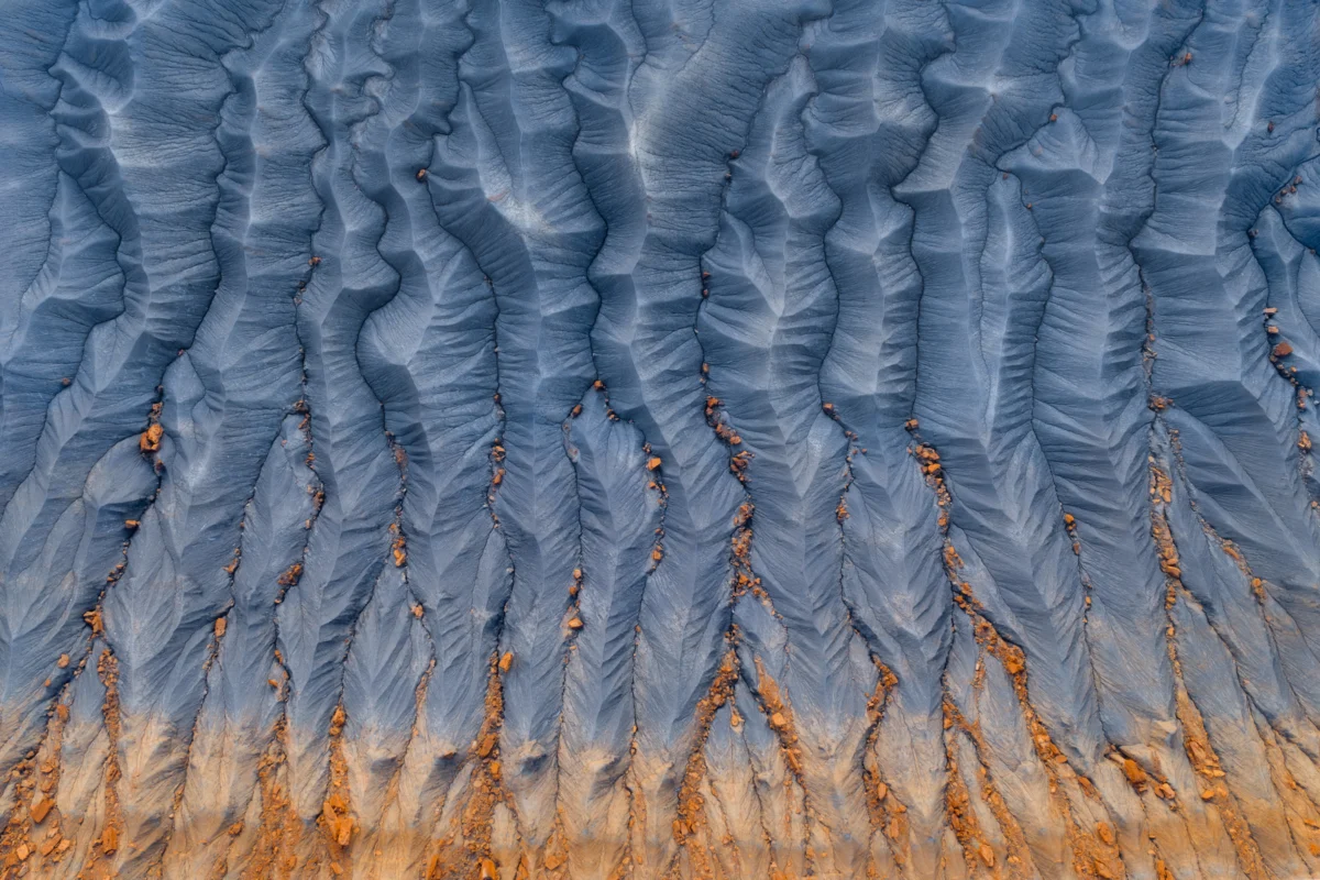
The Mancos Shale, an expansive and frequently misunderstood geological formation spanning hundreds of thousands of square miles across the American Southwest, has increasingly become a focal point for geologists, hydrologists, and environmental scientists. Deposited approximately 90 million years ago during the Late Cretaceous period, this massive sedimentary layer underlies vast swathes of New Mexico, Arizona, Colorado, Wyoming, and Utah. Once settled beneath the waters of the Western Interior Seaway—a shallow, ancient ocean that bisected the North American continent—the formation now shapes the topography, agriculture, and infrastructure of the modern West in profound ways.
Composed primarily of friable gray-blue-brown mudstone, siltstone, and claystone, the Mancos Shale is notorious for its complex weathering patterns, highly erodible nature, and propensity for generating intricate badlands topography. While casual motorists traversing Interstate 70 or regional highways may perceive the barren, dust-caked hillsides merely as monotonous desert scenery, earth scientists recognize the formation as a dynamic, reactive archive of ancient marine environments and a significant driver of contemporary ecological challenges.
Geological Origins and Chronology
The genesis of the Mancos Shale dates back to the Turonian age of the Late Cretaceous epoch, a period characterized by globally high sea levels and warm climates. As the Western Interior Seaway expanded from the Gulf of Mexico to the Arctic Ocean, fine-grained sediments eroded from surrounding tectonic highlands—such as the nascent Rocky Mountains and the Sevier orogenic belt—were transported by river systems and deposited into the deep, quiet waters of the basin.
Over millions of years, the accumulation of organic-rich mud, silt, and calcareous material compacted under thousands of feet of overlying strata. Subsequent tectonic activity, notably the Laramide Orogeny that began roughly 70 to 80 million years ago, uplifted and deformed these marine deposits, exposing them to the surface elements through erosion and weathering. Today, the Mancos Shale outcrops across the Colorado Plateau and adjacent basins, reaching thicknesses that frequently exceed 4,000 feet in specific depocenters like the San Juan Basin.
Supporting Data and Physical Characteristics
The physical and chemical properties of the Mancos Shale present a complex matrix of scientific challenges and economic interests. Because the formation is rich in marine organic carbon, it serves as an important petroleum source rock, hosting significant natural gas and oil reserves that have been targeted by energy extraction industries for decades, particularly within the Piceance and San Juan basins.
However, the shale’s high concentration of soluble minerals—specifically sodium, magnesium, calcium, and sulfate salts—creates severe environmental complications when exposed to precipitation and irrigation runoff. According to data from the U.S. Geological Survey (USGS), the Mancos Shale is one of the primary contributors of dissolved solids and salinity to the Colorado River system. Weathering and erosion of the formation introduce millions of tons of salt into regional waterways annually, impacting water quality for agricultural irrigation, municipal supplies, and downstream ecosystems in both the United States and Mexico.
Furthermore, the geotechnical properties of the Mancos Shale make it notoriously unstable for civil engineering projects. The clay minerals within the shale, particularly smectite and illite, exhibit high shrink-swell capacities. When dry, the rock crumbles into fine, powdery dust that forms intricate, fractal-like erosion patterns known as rills and gullies. When saturated with moisture, the clay expands significantly, exerting immense pressure on foundations, roads, pipeline infrastructure, and structural concrete. State departments of transportation in Colorado, Utah, and New Mexico routinely allocate substantial financial resources to remediate roadbed shifting, slope failures, and landslides triggered by the destabilization of Mancos-derived soils.
Scientific and Official Responses
In response to the dual pressures of resource extraction and environmental degradation, academic researchers, federal agencies, and state regulators have intensified monitoring and mitigation efforts regarding the Mancos Shale. The USGS, in collaboration with the Bureau of Reclamation, maintains ongoing water quality monitoring networks throughout the Upper Colorado River Basin to quantify the salt contribution originating from shale-derived watersheds.
"Managing salinity loading from geological sources like the Mancos Shale requires a coordinated, basin-wide approach," noted a senior hydrologist familiar with regional watershed management plans. "While point sources of pollution can be regulated through industrial permits, diffuse non-point source pollution resulting from the natural weathering of Cretaceous marine shales presents a persistent long-term challenge for water resource managers."
Efforts to mitigate salinity in agricultural regions often focus on improving irrigation efficiency. By transitioning from unlined earthen ditches to closed pipeline delivery systems and implementing advanced sprinkler or drip irrigation techniques, agricultural districts can significantly reduce deep percolation. This reduction minimizes the volume of irrigation water that comes into contact with underground Mancos strata, thereby lowering the quantity of dissolved salts leached into local streams and rivers.
Broader Impact and Implications
Beyond its hydrological and engineering impacts, the Mancos Shale plays a critical role in shaping the ecological and aesthetic identity of the American West. The stark, monochromatic badlands it produces support specialized flora and fauna adapted to high-salinity soils and arid conditions. Plant species such as the Mancos milkvetch (Astragalus humillimus) and various salt-tolerant shrubs have evolved to thrive in the nutrient-poor, highly alkaline environments characteristic of shale outcrops.
At the same time, the visual expanse of the formation defines the landscape of iconic public lands, national parks, and monuments across the Colorado Plateau. The sculptural bluffs, expansive clay flats, and deeply incised canyons carved into the Mancos illustrate the relentless power of geomorphological processes acting upon soft sedimentary rock.
As climate change alters precipitation patterns, shifting the frequency and intensity of monsoonal storms across the Southwest, the erosion dynamics of the Mancos Shale are expected to evolve. Increased storm intensity can accelerate surface runoff, leading to higher sediment loads and elevated salinity spikes in regional watersheds. Consequently, understanding the complex behaviors of this 90-million-year-old formation remains essential for safeguarding regional water security, maintaining civil infrastructure, and preserving the fragile ecosystems of the desert West.